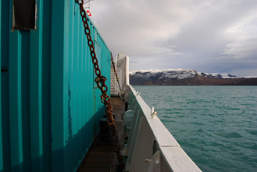
The good news on reaching the Grigory Mikheev, our home for the next 10 days, was that it was the BGS container that made it on-board, and not one full of toothbrushes (my recurring nightmare of the past week or so), and it was dry inside and not flooded (Dave Smith’s recurring nightmare of the past week!) The bad news is that as we steam up the fjord from Kangerlussuaq, western Greenland, there is a Force 6 south-westerly waiting for us at the mouth of the fjord – 4 hours and counting until we start rolling around! I’m starting to spot a theme here after last year’s “rough seas” Cape Farewell Expedition across the Greenland Sea!
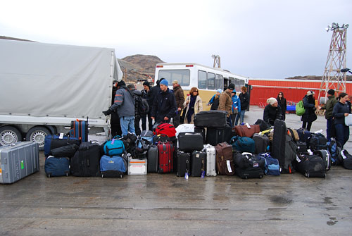
Dave and I have therefore mobilised as much of the equipment as possible tonight while we have a stable deck to work on. Tomorrow morning we will assess the weather and decide if it is feasible to start running our first survey line, which in theory will start mid-afternoon weather permitting. This line is planned to be approximately 50 nautical miles long, crossing the trough mouth feeding out of Disko Bugt itself. An additional factor we will assess with the captain is the amount of ice in the water. From a visit earlier this week, he has informed us that there is very little small ice debris, only large icebergs which are easily visible.




2 Comments
Olga
Will you comment on this survey? It were interesting. And what’s about the Grigoriy Mikheev. Is it a russian vessel?
Respects from Russia.
Carol Cotterill responds to Olga’s question
Dear Olga
Firstly I’m so glad you’re reading the blogs on the Cape Farewell website! So in answer to your questions – yes the Grigory Mikheev is a Russian ship. She used to be a Russian research vessel and has now been converted to accommodate tourists. The crew are Russian, and the staff looking after us onboard are multi-national – Russian, English, Austrian and Beligian.
The survey is very interesting on this expedition. We are using sound to investigate beneath the seabed. We create a bubble in the water, which when it collapses releases a sound wave. We use marine microphones called hydrophones to listen to the sound being reflected back from the seabed initially, and then each sediment boundary beneath the seabed in turn. We are managing to “see” up to 400m beneath the seabed in places which is incredible for us!
I need to spend some time interpreting the profiles – like 2D slices through the seabed – but we have seen channels gouged out by old ice flows that have now been infilled with 100’s meters of sediments.
There are lots of interesting features being revealed. However, the nature of science is that we need to go back and place our data into the big mix of existing data from this area in order to understand the detailed picture of what is happening and has happened in the past!
If you, or anyone else has any other questions, please send them in and I will try to answer them as soon as I can.
Stephen White
Hi Cape Farewell Team,
Some wonderful images – great to see this all come to fruition ! Haven’t had a chance to read through all the blog but will be keeping track throughout the week. Sounds like it’s been a bit choppy for the start of the voyage and it looks cold!!
Some great pics of DB, V & H – lots of love to you all,
Stephen x