Sorry I haven’t been blogging for a couple of days, but events and activities got the better of me! I was convinced we were on Wednesday today and was shocked that it is actually Friday! Somehow the Arctic induces a complete loss of any realisation of time, date and day.

Ice cave at Sermeq Avangnardleq. Photo: Carol Cotterill
On Tuesday evening (30th September) we ran a profile past the mouth of the Torssukatak fjord, into which two large glaciers feed, and up into the Suvdlorssuaq passage which runs between Disko Island and the Nugssuaq Peninsula. We have clearly imaged what I think are the lateral moraines for an old ice stream, standing proud of the seabed. There are also multiple channel incisions with sediment infilling.
Science met art when Ryuichi Sakamoto used a hydrophone to record our seismic signal and the reflections from the seabed and below. He is keen to try and form some sort of sound piece by combining this with our analogue signal and recordings of the glaciers and icebergs.
On Wednesday 1st October we landed in Uummannaq – located on an island to the north of the Nugssuaq Peninsula. Shore visits included going to the local museum who had a great exhibition on Wegener’s last expedition onto the Greenland Icecap, from which he never returned. We also visited a children’s home where the predominant therapy is encouraging a remarkably close relationship to the surrounding land. The boys are given dog teams to look after, and it is normal for the whole home to go onto the sea ice during winter and travel and camp in the wilderness for months at a time, hunting, fishing and learning survival skills.
In order to encourage continual learning about the land, the couple who run the home have set up the Uummannaq Polar Institute. Any scientists or artists wishing to undertake research in this area of Greenland are given lodging here in return for information, data or working with the kids explaining about the evolution of the land. I have promised a set of the seismic profiles we have run here, along with interpretations, for the Institute, as a way of encouraging them to view the marine system as part of the overall glacial environment.
Thursday saw us arriving at the Perdlerfiup Sermia Glacier, located at 71O N – the furthest north we have been so far. In the morning I gave a talk from the bridge on glaciers, recorded by Quentin Cooper and Peter Gilbert’s film crew, describing the geomorphology around us in terms of the main drivers for glacial flow, calving, moraine development and advance / retreat cycles. Whilst no glaciologist, I was still able to answer the majority of questions! This was followed in the afternoon by a shore visit to the now land terminating Sermeq Avangnardleq Glacier where Dave and I were able to actually point features out and show people striations, moraine debris and one of the most impressive ice-front caves I have seen.
There was general amazement at the presence of a glacial river flowing out from under the glacier, although I had pointed out that they often formed as a result of basal sliding, moulins and water entering the system through crevasses (my apologies here to Jez, Tom et al in Edinburgh for simplifying the physics of glaciers!) There was also a stream of people bringing us pretty coloured rocks and asking what they were! The richness of the mineral deposits around here is quite incredible, with large iron rich veins showing clearly in the mountains surrounding us.
Ryuichi asked if Dave and I had been surveying that afternoon. I was surprised that me saying “No, we were onshore looking at the glacier” resulted in a huge hug and much smiling! It turned out that he had been recording sound from a RIB, and had heard several large bangs – the sound of ice cracking prior to a calving event. Having listened to it myself I am amazed how loud the ice is compared to our seismic source.
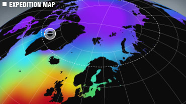
Whilst close to the ice front, I filmed some footage with Joe Smith from the Open University, who is working on a project for a new course. He plans to create an interactive map of our journey, where clicking on icons takes you into interviews, video footage or photographs. We were trying to emphasise that whilst the land may appear stable on long timescales, that it is actually a dynamic system with many interactions and feedback mechanisms.
Today Dave and I will be running another profile as we leave the glacier, surveying perpendicular to the glacier front, running along the axis of the fjord. I hope that this will give another perspective to the cross-channel profiles I have so far been asked to explain!
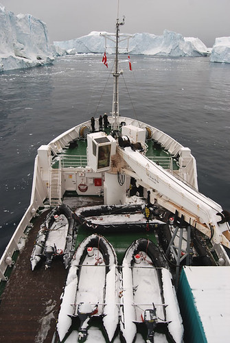
Jakobshavn Glacier. Photo: Carol Cotterill
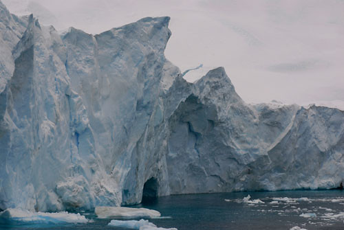
Jakobshavn Iceberg. Photo: Carol Cotterill
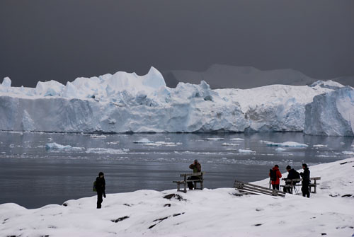
Jakobshavn Icefield. Photo: Carol Cotterill

Perdlers Icefront. Photo: Carol Cotterill
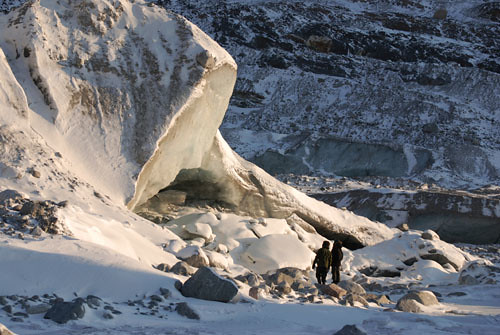
Sermeq Avangnardleq. Photo: Carol Cotterill

Sermeq Avangnardleq. Photo: Carol Cotterill

Uummannaq. Photo: Carol Cotterill
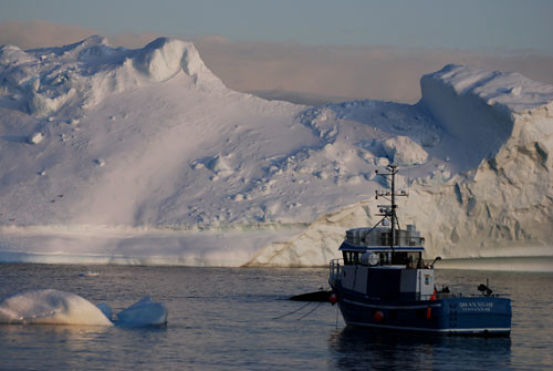
Uummannaq. Photo: Carol Cotterill

3 Comments
Birdie
dropped a note about the expedition to Dr. Kate Hutton, seismologist at Caltech. I imagine Greenland would be a nice vacation spot for her I’ve also determined that Palin needs a really really good lecture on what happens when major earthquakes, oil rigs, and melting glaciers get together in her home state….and everybody else should be listening in to it. I expect the blogging will keep on for awhile, yes?
Glenda
Wow – spectacular photos. Huge envy from this side of the Pacific. Hope you’ve had a wonderful time – I think today is the last day. Your knowledge of glaciers far tops mine – I’ll have to get a fresher from you next time I’m in your part of the world. Take care friend – hope you’ve had a wonderful journey.
Birdie
Carol
USGS released a report today – 99% of glaciers in Alaska retreating or thinning….. google Alaska Glaciers. Next, we need a report dealing with earthquakes/glacier melt issues/alaska. Someone has to be working on it