Follow the Expedition
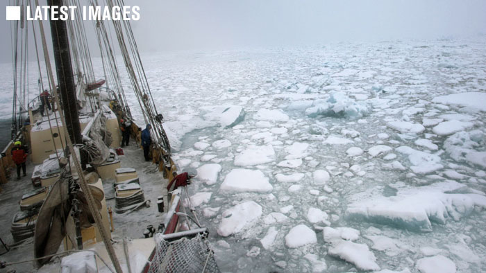
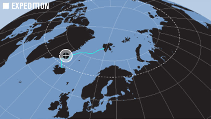
Follow our journey plotted in text, images, sound and video on the map, broadcast back by satelite directly from the deck of the Noorderlicht. The voyage crossed the Greenland Sea from Longyearbyen, Svalbard on the 78th parallel to the East Coast of Greenland. Sailing south and unable to enter Scoresby Sund due to the level of melting sea ice, we explored the coastal fjords of East Greenland’s Blosseville Coast before crossing the Denmark Straits to complete the voyage in Akureyri, Iceland.
About the Interactive Map
Click and grab or use the controls to naviage the map. It’s powered by Google Maps and Geo Mashup. We hope you enjoy it! The areas in the High Arctic we are voyaging to are remote and there are limits to the map detail available. Zoom in too far and you’ll reach a point where there is no map detail – just zoom out a bit. This is a great tool, but not all web browsers will run it perfectly. If your browser has problems displaying the map information we’re very sorry, but for everyone else enjoy!